Point Clouds, Meshes & 3D Modeling
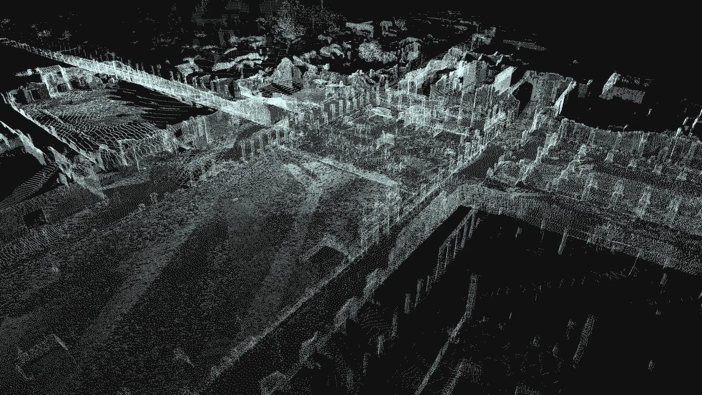
Point Clouds
Your Jobsite, Digitized to the Centimeter.
In construction and other built‑environment industries, teams constantly battle outdated drawings, incomplete measurements, and site conditions that change faster than documentation can keep up. This disconnect leads to rework, coordination errors, and costly surprises in the field. High‑resolution meshes and 3D models solve this by giving every stakeholder a precise, navigable digital replica of the real world — accurate down to the centimeter. They capture true geometry, elevation, and structure, allowing teams to verify as‑builts, detect clashes, plan installations, measure remotely, and visualize progress with absolute confidence. Instead of guessing what’s on site, you see it — clearly, accurately, and in full 3D.
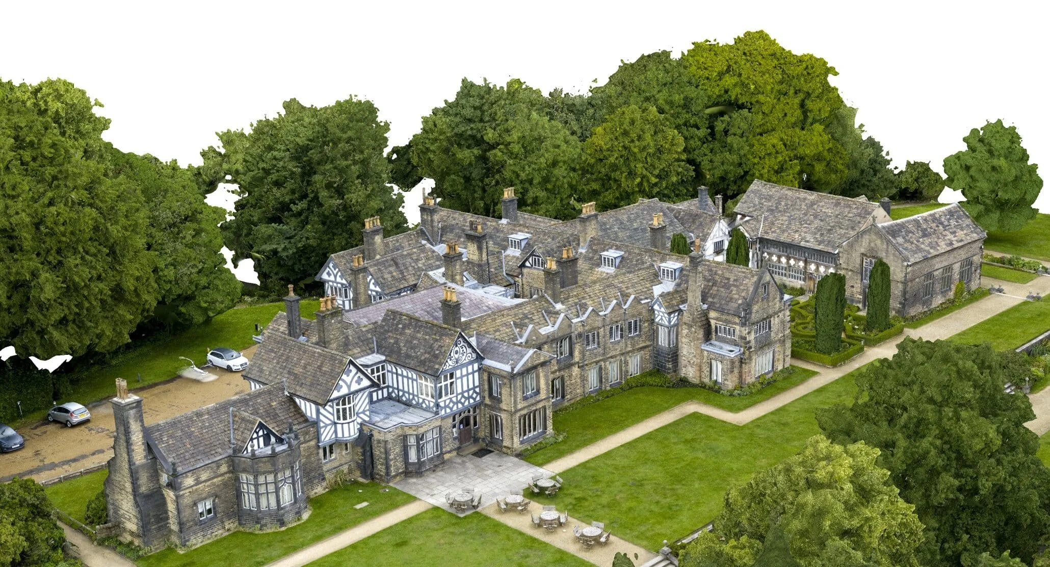
Turning raw spatial data into a usable 3D model happens in a few straightforward steps. Millions of measurement points are first captured and compiled from a site drone scan to form a spatial point cloud — a dense “constellation” of XYZ points that together build surface topographies. Software connects those points into a framework of continuous surfaces made of triangles that define the true shape and geometry of scanned environments called a mesh. Textures, imagery, and metadata are then applied to produce a polished 3D model that’s easy to view, measure, and integrate into BIM, CAD, or visualization workflows. The result is a clean, accurate digital twin that teams can explore, analyze, and rely on throughout the entire project lifecycle.
Turn the Jobsite into a Digital Tape Measure
A Point Cloud gives your team the power to measure anything — length, height, area, even volume — from anywhere. It delivers the clarity crews need in the field and the accuracy you need to make decisions with confidence, dramatically reducing costly mistakes and rework.
Integrating Point Clouds into your construction workflow, you get:
Exact measurements you can verify, repeat, and defend
Every dimension is grounded in real‑world, survey‑grade data.
Full‑site visibility, including hard‑to‑reach or hazardous areas
Inspect conditions safely and remotely without slowing down operations.
Reliable as‑built documentation for coordination, RFIs, and progress validation
A precise record of what exists today — not what the drawings say exists.
Point clouds give you the raw, measurable truth — no guesswork, no blind spots.
Meshes
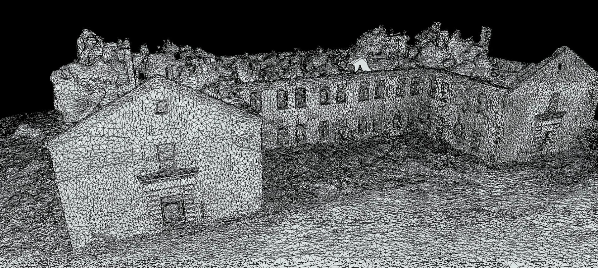
Know your worksite intimately
A Mesh turns raw site data into a realistic, easy‑to‑understand 3D representation of your worksite — giving you instant clarity on grading, elevation changes, structural relationships, and hard‑to‑see details.
Integrating Meshes into your construction workflow, you get:
Client‑friendly visuals that communicate instantly
Clear, intuitive 3D views that anyone — even non‑technical stakeholders — can understand at a glance.
Accurate geometry for planning, design reviews, and clash detection
Real‑world surfaces and shapes you can trust for measurements, layout checks, and coordination.
Immersive context for stakeholders who need clarity, not complexity
A true-to-life model that shows how everything fits together, reducing confusion and eliminating guesswork.
Meshes turn complex site data into a visual experience that accelerates decisions.
Exterior 3D Models
The Combined Advantage
A 3D model turns the entire jobsite into an interactive, measurable, immersive environment — making visual details pop, coordination smoother, decisions faster, and mistakes far less likely.
When you combine point clouds and meshes, you get a complete, cinematic understanding of your project:
Together, point clouds and meshes deliver a complete, cinematic understanding of your project:
The accuracy of survey‑grade data
Every measurement, angle, and elevation is grounded in reality.
The clarity of photorealistic 3D models
Complex conditions become instantly understandable for any audience.
The speed and efficiency of aerial capture
High‑fidelity site intelligence delivered without disrupting operations.
It’s the difference between hoping you have the right information — and knowing you do.
How This All Fits Together
Once you have your orthomosaic, point cloud, mesh, and 3D model, the real value begins. These deliverables become the single source of truth for what actually exists on site — accurate, current, and measurable. From here, every team can plug this data directly into the tools and workflows they already use.
Teams load the point cloud, mesh, or 3D model into their preferred software — CAD, BIM, GIS, project management platforms, or simple viewers.
The model becomes the authoritative reference for dimensions, conditions, and progress — eliminating guesswork and outdated drawings.
Foremen use it as a digital tape measure, making fast, accurate field decisions without walking the entire site.
Crews visualize upcoming work, understand sequencing, and coordinate installs with fewer surprises.
Architects design directly on top of reality, ensuring renovations fit, clashes are caught early, and design intent aligns with actual conditions.
3D models become powerful communication tools, helping non‑technical stakeholders understand the site instantly.
The data becomes long‑term documentation, capturing exactly what was built, when it was built, and how it changed over time.
In short: these deliverables don’t just show the site — they streamline decisions, reduce rework, and keep every team aligned around the same, accurate source of truth.