What can we deliver for you?
Our Services

-
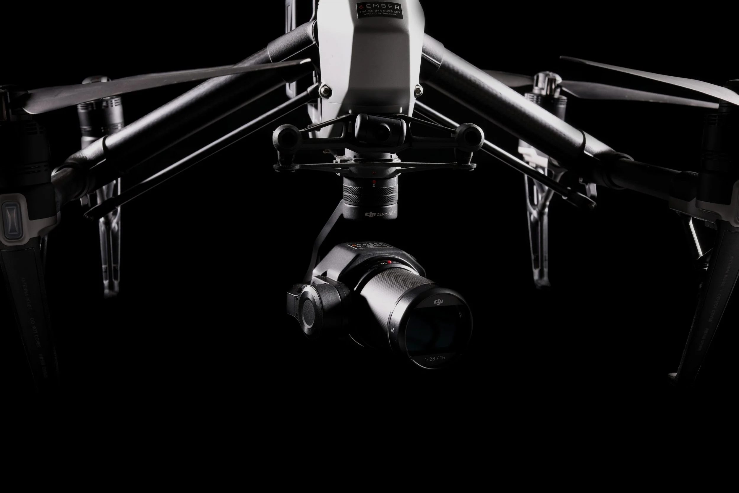
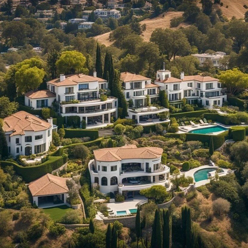
Bring your vision to life with stunning aerial photos and cinematic videos—perfect for showcasing real estate, promoting commercial properties, capturing breathtaking landscapes, or documenting the energy of live events from a striking vantage point. Our high-resolution imagery adds polish and professionalism to your brand story, marketing content, or project presentations—helping you stand out in crowded markets.
From construction progress documentation to retail marketing campaigns, from weddings and public events to architectural storytelling, our drone cinematography adapts to your goals. We tailor each capture to highlight what matters most—whether it’s scale, setting, or atmosphere—delivering visuals that are both informative and emotionally compelling.
When every detail counts, let your story rise above—literally.
-
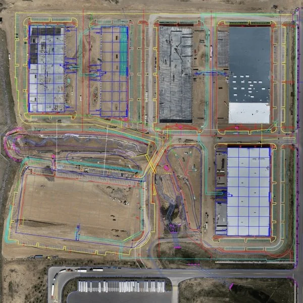
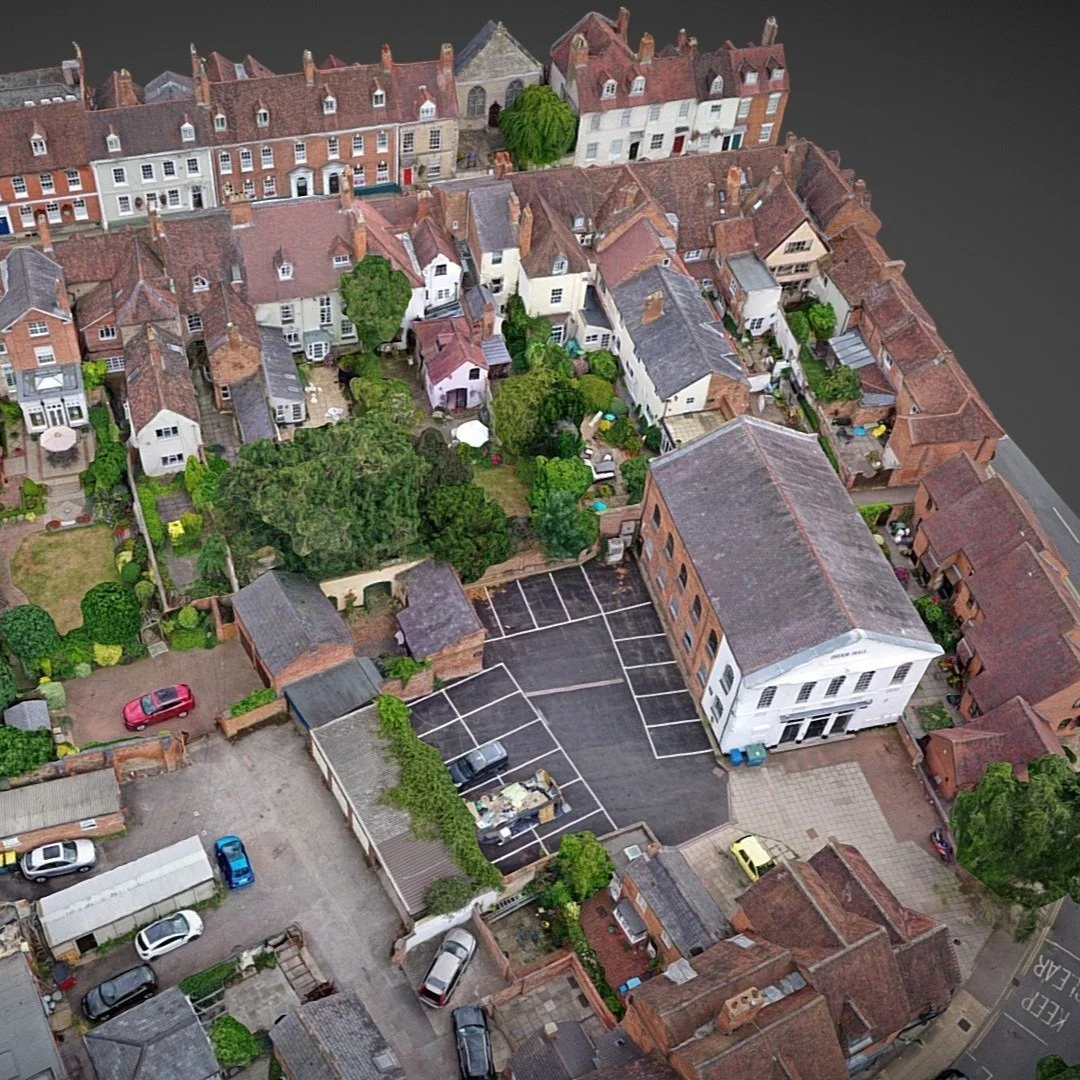
Partner with our skilled drone pilots to capture precision aerial imagery across your worksite—leveraging (RTK / PPK) positioning for survey-grade accuracy. Our high-resolution imagery is ideal for generating detailed orthomosaics, topographic maps, and 3D surfaces that support confident planning and design.
Develop project overlays and design plans with the accuracy you need and the turnaround you want. A drone pilot working alongside a licensed surveyor forms a powerful partnership—combining aerial coverage with ground control to map large areas efficiently while maintaining exceptional precision.
It’s an intelligent, high-efficiency solution—from the sky down.
-
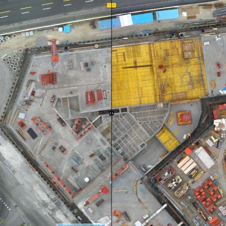
Track your site’s progress with precision and confidence. Our construction progress monitoring service combines high-resolution aerial drone imagery with interior 360° scans to deliver a consistent, sequential visual record of your project. From groundbreaking to final walkthrough, we capture every phase with clarity—providing time-stamped updates that support documentation, quality control, stakeholder communication, and compliance.
Visualize developments as they unfold with side-by-side comparisons, overlay design plans for clash detection, and showcase milestone achievements with professional-grade visuals. Whether you're aligning subcontractors, reporting to clients, or building a historic timeline for future reference, our imagery ensures that everyone stays informed and accountable—from boardroom to build site.
It’s a smarter, faster way to document progress, mitigate risks, and move your project forward—one scan, one flight, one milestone at a time.
-
Turn your space into detailed, dimensionally accurate floor plans with advanced LiDAR scanning. Our services harness precision laser technology to capture spatial data at millimeter-level accuracy—converting real-world interiors into clean, scalable digital layouts. Whether you're managing a construction site, coordinating a renovation, marketing real estate, or planning architectural changes, our scans give you the clarity and confidence you need from day one.
From space optimization to asset tracking and compliance documentation, we deliver actionable floor plans tailored to your workflow. Available in multiple file formats compatible with CAD, BIM, and visualization platforms, our data ensures seamless integration into your design or facility management tools.
Don’t just map your space—understand it, plan it, and build with certainty.
-
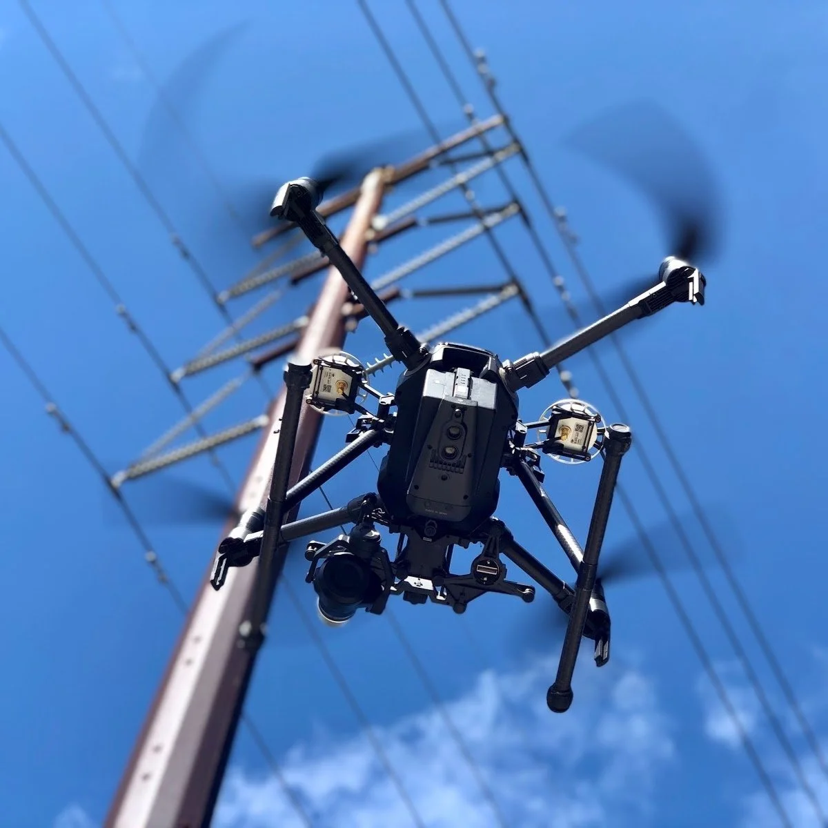
Capture critical inspection data with precision, safety, and speed—without ever leaving the ground. Our aerial drone services are purpose-built for accessing hard-to-reach areas like rooftops, facades, towers, and elevated infrastructure—eliminating the need for scaffolding, ladders, or downtime. We collect high-resolution images and video that help you spot issues early, document conditions, and plan next steps—all while reducing risk and operational disruption.
Take your inspections even further with dimensional 3D models and photorealistic renderings that deliver measurable insights. Whether you're evaluating asset conditions, planning repairs, or documenting for compliance, our data-rich deliverables empower better decisions with fewer site visits.
It’s a smarter way to inspect—efficient, detailed, and grounded in safety from takeoff to touch down.
-
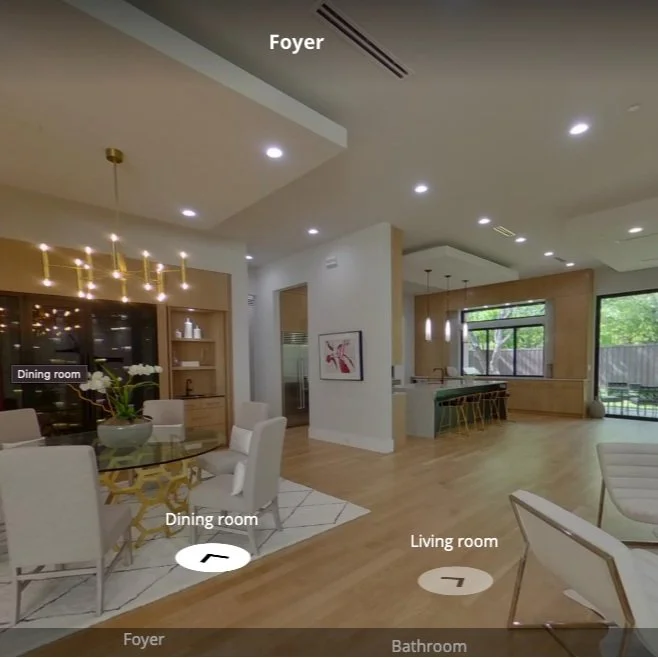
Engage your audience with immersive 360° captures and dynamic 3D virtual tours—purpose-built for real estate, retail, restaurants, wellness studios, construction sites, and manufacturing facilities. The applications are virtually endless.
For real estate and customer-facing businesses, invite guests to explore your space online as if stepping through the front door—building trust, sparking curiosity, and creating meaningful connections before they ever arrive.
In construction and manufacturing, enable seamless collaboration and track site progress over time by capturing critical features and environmental conditions—building a visual record for future reference. Overlay key data streams (including IoT) to bring your virtual spaces to life with real-time insights.
It’s storytelling through space—available anytime, anywhere.
-
Bring your projects into sharper focus with detailed 3D models, textured meshes, high-resolution orthomosaics, and point clouds—delivered in the file format that fits your needs, not ours. Whether you're capturing inspection imagery, documenting a construction site, designing a floor plan, or crafting a compelling 3D virtual tour, our aerial and terrestrial imaging solutions generate accurate digital twins that serve a wide range of industries—from construction, architecture, and engineering to real estate, retail, hospitality, manufacturing, and public works.
We understand that every workflow is different, which is why we stay fully platform-agnostic—delivering your data in the formats that integrate seamlessly with your tools, whether you're working in CAD, GIS, BIM, digital twins, or immersive media platforms. LAS, LAZ, DXF, OBJ, E57, XYZ, TIFF, JPEG, MP4—your deliverables, your way.
It’s data you can see, trust, and act on—ready for planning, measuring, showcasing, and collaborating without compromise.