
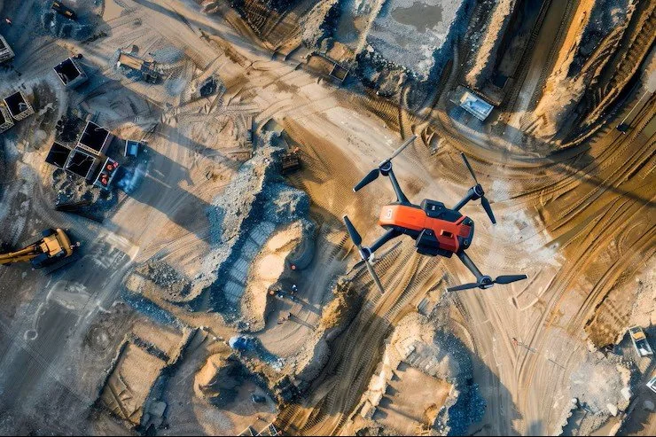
Drone Mapping & Progress Monitoring for Construction & Development in the Bay Area
High‑accuracy aerial mapping and progress documentation that give builders a clear, measurable view of every phase — from orthomosaics and elevation data to time‑aligned progress imagery, comparative overlays, and interior 3D scans that capture real‑world conditions with precision.
Why Construction Team Choose Droneology
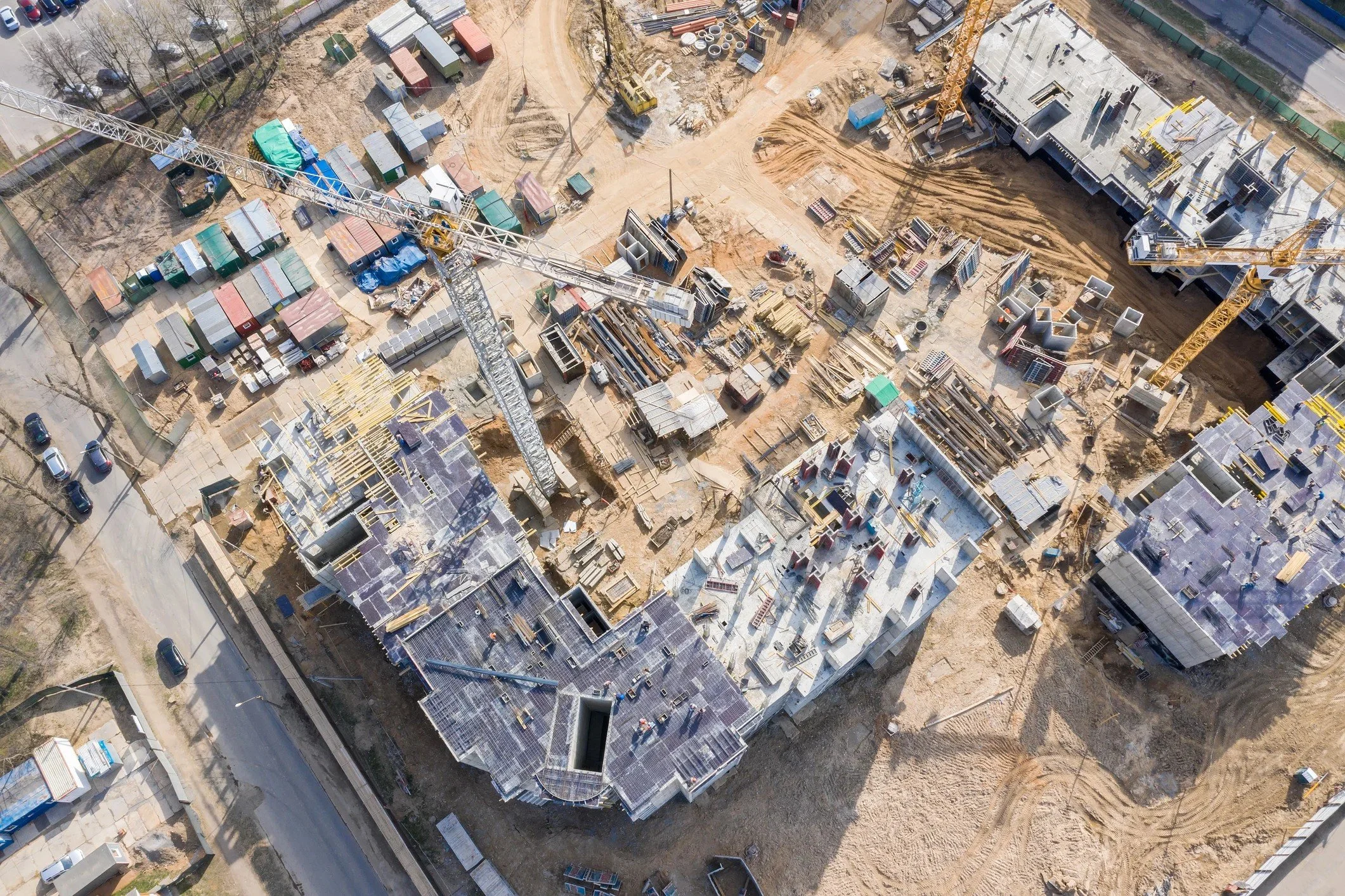
Droneology helps Bay Area builders, developers, and project managers document sites with clarity, accuracy, and visual consistency. Our aerial mapping and interior scanning workflows create a reliable record of every phase — supporting coordination, verification, and confident decision‑making from groundbreaking to closeout.
High‑accuracy drone mapping & orthomosaics
Elevation data, contours & measurable site models
Comparative overlays for tracking change over time
Consistent progress imagery from fixed aerial positions
Interior 3D scans for as‑built documentation & verification
Droneology Mapping & Progress Monitoring Media Packages
-
A baseline documentation set for small contractors or early‑phase projects needing simple, reliable visual records.
Includes:
Aerial RTK stills (cardinal directions + nadir)
Basic orthomosaic (non‑survey grade)
Exterior site overview imagery
Light progress documentation (1 capture set)
Best for:
Small GCs, remodels, tenant improvements, early‑phase site checks.
Price begins at $495
-
A practical, data‑forward package for accurate site understanding and early‑stage planning.
Includes:
RTK Mapping flight
High‑accuracy orthomosaic
Elevation data (DSM/DTM)
Contours (1–2 ft)
Basic comparative overlay (previous capture vs. current)
Export-ready imagery for CAD/GIS platforms
Best for:
Builders needing accurate site conditions, grading checks, and planning support.
Price begins at $950
-
A repeatable, consistent documentation workflow for tracking construction progress over time.
Includes:
RTK Mapping
Orthomosaic + elevation data
Fixed-position progress imagery (same angles every visit)
Comparative overlays (multi‑date)
360° ground-level walkthrough (non‑LiDAR)
Export set for project managers & stakeholders
Best for:
Monthly or bi‑weekly progress tracking, reporting, and coordination.
Price begins at $1,450
-
A combined aerial + terrestrial capture for documenting real‑world conditions inside and out.
Includes:
RTK Mapping + orthomosaic
Elevation data + contours
LiDAR/360 terrestrial interior scan (platform‑agnostic)
Interior 3D walkthrough
Point cloud export (E57 or LAS depending on platform)
2D floor plan export
Optional 3D floor plan (add‑on)
Best for:
As‑built verification, remodels, tenant improvements, insurance documentation.
Price begins at $2,250
-
A comprehensive aerial + terrestrial dataset for teams needing measurable 3D assets.
Includes:
RTK Mapping
High‑accuracy orthomosaic
DSM/DTM + contours
Aerial point cloud (photogrammetry)
Terrestrial LiDAR/360 scan
Combined point cloud (aerial + terrestrial)
3D mesh model export
CAD‑ready deliverables (OBJ, DXF, or compatible formats)
Best for:
Architects, engineers, developers, and teams needing measurable 3D data.
Price begins at $3,500
-
A multi‑phase, multi‑deliverable package for developers managing large or complex projects.
Includes:
Monthly or bi‑weekly RTK Mapping
Orthomosaics + elevation models
Comparative overlays (multi‑date)
Aerial + terrestrial point clouds
360° interior scans for each phase
3D model updates
Export set for CAD, BIM, and project management platforms
Cloud hosting + archival storage
Best for:
Developers, large GCs, multi‑building projects, long‑term construction.
Price begins at $5,500
-
A fully customizable, high‑touch service for large construction firms, multi‑site operations, or developers needing continuous data.
Includes:
Everything in the Developer Oversight Package
Multi‑site or multi‑building coverage
Dedicated capture schedule
Priority turnaround
Integration support (CAD, BIM, GIS, PM tools)
Quarterly executive‑level reporting
Long‑term hosting + data management
Best for: Enterprise builders, commercial developers, engineering firms.
Price begins at $8,500
Droneology Construction Media Request
Tell us about your jobsite or loss location, when you’d like us on site, and how we can access the area. Once we review your request, we’ll confirm the scope, timing, and any documentation requirements needed for your mapping, progress monitoring, or insurance claim.
For general questions or to schedule a call, please use our Contact Form instead.